日本の場合は、どこにその基準となる水準点があるか知っていますか?
English text is at the bottom of the page.
海外の現場で高さ基準を決める作業が日本と同様にありますが、日本の場合どういった形で基準が設けられ、設定されているかを知っていると応用が出来ます。そして、説明する際などに役にたちます。
それは、国会議事堂の近くにあるこちらの施設です。
大日本帝国と書かれています。
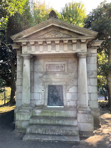
こちらは、明治24年(1891年)に設置された土地の標高を測定するための基準点です。こちらの中には、水晶板があり、そこに基準となる高さがあります。ちなみに過去、大地震などで、その標高を修正しています。
住所は、東京都千代田区永田町一丁目一番二号
国の重要文化財に指定されています。
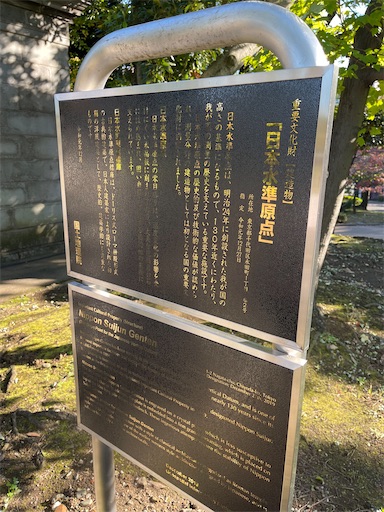
関連して、最近は電子基準点も使われており、上記施設の隣にそれがあります。
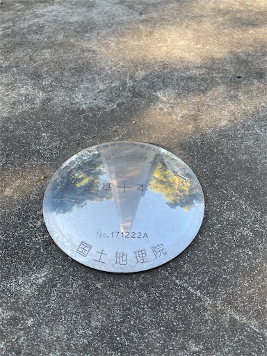
決して、動かさないように。笑
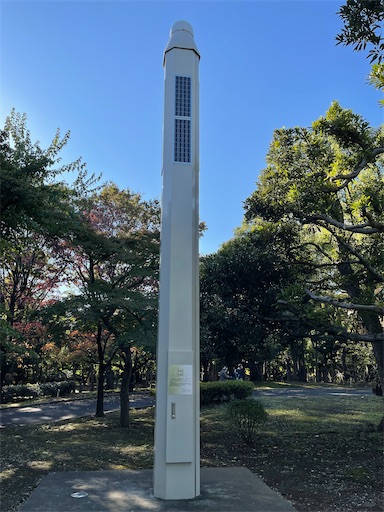
こちらの電子基準点は、GPSなどの衛星から出された電波信号を受信しています。その情報は、国土地理院に送信されており、土地や地図作成の際の基準点として利用されています。
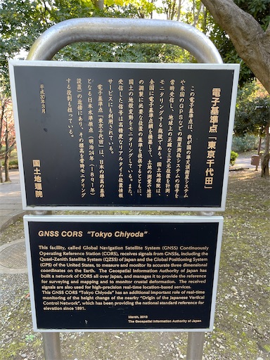
特にポイントとしては、地震予知に利用されている点です。電子基準なのでリアルタイムで地殻変動を確認でき、その変動(土地の歪み)を計測する事で震源を突き止めるなど地震予知に利用されています。精度は、結構良いと何かの記事でみた記憶があります。
個人的に有名なものとしては、MEGA地震予測ですね。
The following in English
Title:In the case of Japan, do you know where the standard level point is?
There is the same process of determining height standards at overseas sites as in Japan. If you know how the standards are established and set in Japan, you can apply them. It is also useful when explaining.
It is this facility located near the Diet Building.
It is labeled "Dai-nippon teikoku"
photo
This is a reference point for measuring the elevation of land, established in 1891 (Meiji 24). In this section, there is a crystal plate that measures the height of the reference point. Incidentally, the elevation was revised in the past when there was a major earthquake.
The address is Nagata-cho 1-gai 2, Chiyoda-ku, Tokyo.
It is designated as an important cultural property of Japan.
photo
Recently, electronic reference points have been used. It is located next to the above facility.
photo
Never, ever move it.
photo
These electronic reference points receive radio signals sent out from satellites such as GPS. The information is transmitted to the Geospatial Information Authority of Japan (GSI), which uses it as a reference point for land and mapping purposes.
photo
The point is that it is being used for earthquake prediction. Digital technology allows us to see crustal movement in real time, and by measuring the movement (distortion of the land), we can locate the epicenter. I remember seeing in some media that the accuracy is quite good.
Personally, the most famous one is the MEGA earthquake prediction.